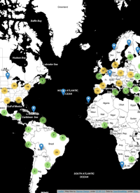
Check out this video of the evolution of OpenSteetMap in Europe! It sure is cool to see how much ground a bunch of nerds with GPS units can cover! Link courtesy of slashgeo.org.
- Wed 27 October 2010 cfarmer
OSM data by country
Thu 13 May 2010 cfarmerFor part of a traffic simulation project I am currently working on we need country-wide road network data for Ireland. In the past, getting decent road network data for an area this large was quite a task (not to mention expensive and time consuming), however, with OpenStreetMap we have access to this type of data instantly, and for free! In order to download full country coverage all at once, all I had to do was turn to this extremely useful site, which provides links for daily excerpts of OpenStreetMap data for any country in Europe plus several non-country regions such ...
Open up your online maps with OpenStreetMap
Mon 26 January 2009 cfarmerOpenStreetMap (OSM) is a project designed to create and provide free spatial data (street maps) to anyone and everyone who wants them. It is based on an open-source philosophy, and combines wiki-like user generated data, with free access, allowing users to create, edit, download, and use OSM data to their hearts content. According to the OSM website, “the project was started because most maps you think of as free actually have legal or technical restrictions on their use, holding back people from using them in creative, productive or unexpected ways.” There are now tones of websites and open-source software projects that incorporate OSM data, and the growing popularity of the site means that the data is only going to get better (more accurate) and bigger (more data).
1 / 1
