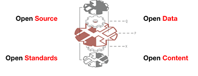
Here’s a blog post from ESRI about ESRI’s transition to open source, open development, and social coding.* It features GitHub pretty prominently, which continues to be an awesome resource for collaborative work — and not just for code. My colleagues and I have started using it for planning meetings and workshops, developing research papers, maintaining websites (this site is hosted on GitHub), and yes, even open source software projects. ESRI obviously also thinks GitHub is a useful resource, and their keynote for the ESRI DevSummit is GitHub CEO and Co-Founder Chris Wanstrath!
- Wed 12 March 2014 cfarmer
SciPy 2014 Geospatial Data in Science
Thu 06 March 2014 cfarmerI have recently been asked to help out with the Geospatial Data in Science track for SciPy 2014 in Austin, Texas this coming July. The conference is being held at the AT&T Executive Education and Conference Center at the University of Texas campus in Austin, Texas from July 6th to 12th 2014. It promises to be an awesome gathering of scientific Python users, developers, and organizations. You can checkout the conference announcement on the SciPy 2014 website, where you can register to submit a proposal and/or abstract, and generally find out all about the SciPy community and conference.
CARSI is looking for research assistants
Wed 05 March 2014 cfarmerWe have two openings for undergraduate research assistants here at the Center for Advanced Research of Spatial Information. You can find the original announcement on Dr. Carsten Keßler‘s website. In short, we are looking for
- A student who can help us move our website over to WordPress (detailed description); and
- A student who can support us with Android app development in the enviroCar project (detailed description).
If either of these topics sounds interesting to you, please get in touch with myself or Dr. Carsten Keßler.
First GTECH Experiment Recording
Wed 05 March 2014 cfarmerIn case you missed Eric Brelsford’s talk last Wednesday on Free & Open Source Software for Geospatial Applications, I’ve embedded the recording below for your viewing pleasure (Eric’s slides are also available). This is the first in a series of talks organized within the department of Geography at Hunter College, CUNY around GIS and Technology (we’re calling them GTECH Experiments). Each talk is organized by a student (thanks go to Mara Gittleman this time), and features a member of the wider geo-technology community. Check out the video below:
Stay tuned for news and events around GTECH Experiments in the future!
NYC Geoclient REST API from Python
Sat 01 March 2014 cfarmerRecently, on the betaNYC Meetup email list, John Krauss and Tom Swanson both posted Python code for accessing the NYC Geoclient REST API, which is an awesome resource developed by the NYC Department of Information Technology and Telecommunications GIS/Mapping unit.
The Geoclient API is a RESTful web service interface to the NYC Department of City Planning’s Geosupport system developed by the Department of Information Technology and Telecommunications GIS/Mapping unit. Geosupport is a mainframe-based geocoding system used by NYC government. Geosupport provides coordinate and geographic attributes for supported input locations (address, intersection, blockface). Geoclient exposes the most widely ...
Eric Brelsford Guest Speaker
Fri 21 February 2014 cfarmerPlease join us Wednesday, February 26th from 3:00 to 5:00 pm in the Hunter College Geography Conference Room (Hunter North 1004) for a talk by guest speaker Eric Brelsford, who will be talking about Free & Open Source Software for Geospatial Applications.
UPDATE: If you can’t make it in person, check out a live feed of the talk here.
Topic: Eric will give us an overview of the Free & Open Source Software for Geospatial Applications (FOSS4G) terrain, followed by a few examples of workflow. What tools are out there for making useful and interesting online maps? What is ...
Call for Abstracts: 2nd International Conference UREC 2014
Fri 07 February 2014 cfarmerThe Urbanization and Global Environmental Change Project is pleased to announce that we will begin accepting abstracts for our 2nd International Conference on February 7th.
We invite abstract submissions for oral and poster presentations. We particularly encourage contributions that exhibit an innovative set of conceptual and methodological approaches. Abstracts should be focused on synthesizing UGEC research, lessons learned, key ways forward, and should fall under one of the four conference themes:
- Urbanization Patterns and Processes
- Urban Responses to Climate Change: Adaptation, Mitigation and Transformation
- Global Environmental Change, Urban Health and Well-Being
- Equity and Environmental Justice in Urban Areas
Urbanization and Global Environmental Change Conference 2014
Mon 03 February 2014 cfarmerThe Urbanization and Global Environmental Change (UGEC) 2nd International Conference on “Urban Transitions and Transformations: Science, Synthesis and Policy” is scheduled to take place in Taipei, Taiwan from November 6th-8th, 2014. I am organizing a special session entitled “Forecasting Urbanization: Population and Land Dimensions” which promises to be very exciting.
This is the ‘final wrap-up’ for UGEC, so the main purpose of the conference is tp provide a synthesis of UGEC research and practice. Sessions are supposed to be reflective (i.e., not solely presentations on ‘new research’), so the talks should have a ‘lessons learned’ focus. Hopefully there will ...


