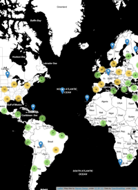
Last fall, Carsten Kessler and I gave a online talk about our EnviroCar project. The talk was entitled “EnviroCar - A GIS Framework for Citizen-based Environmental Monitoring in NYC” and was hosted by the New York State GIS Association. It was the first talk of the Transportation Professional Affiliation Group, which was quite an honor for Carsten and I. Check out the NYSGIS YouTube channel for more awesome talks, and check out the following embedded video to see the EnviroCar recording:
- Fri 16 January 2015 cfarmer
Submission deadline extended!
Sun 16 March 2014 cfarmerDue to popular demand, the deadline for submitting talks, tutorials and posters has been extended to April 1, 2014 - no ‘foolin!’. We encourage submissions related to general scientific computing with Python, one of the two special themes for this year, or the domain-specific mini-symposia held during the conference. Take a look at a few talks from previous years, our guidelines for this year, and we look forward to reviewing submissions!
SciPy 2014 Geospatial Data in Science
Thu 06 March 2014 cfarmerI have recently been asked to help out with the Geospatial Data in Science track for SciPy 2014 in Austin, Texas this coming July. The conference is being held at the AT&T Executive Education and Conference Center at the University of Texas campus in Austin, Texas from July 6th to 12th 2014. It promises to be an awesome gathering of scientific Python users, developers, and organizations. You can checkout the conference announcement on the SciPy 2014 website, where you can register to submit a proposal and/or abstract, and generally find out all about the SciPy community and conference.
CARSI is looking for research assistants
Wed 05 March 2014 cfarmerWe have two openings for undergraduate research assistants here at the Center for Advanced Research of Spatial Information. You can find the original announcement on Dr. Carsten Keßler‘s website. In short, we are looking for
- A student who can help us move our website over to WordPress (detailed description); and
- A student who can support us with Android app development in the enviroCar project (detailed description).
If either of these topics sounds interesting to you, please get in touch with myself or Dr. Carsten Keßler.
First GTECH Experiment Recording
Wed 05 March 2014 cfarmerIn case you missed Eric Brelsford’s talk last Wednesday on Free & Open Source Software for Geospatial Applications, I’ve embedded the recording below for your viewing pleasure (Eric’s slides are also available). This is the first in a series of talks organized within the department of Geography at Hunter College, CUNY around GIS and Technology (we’re calling them GTECH Experiments). Each talk is organized by a student (thanks go to Mara Gittleman this time), and features a member of the wider geo-technology community. Check out the video below:
Stay tuned for news and events around GTECH Experiments in the future!
One year in New York City
Fri 03 January 2014 cfarmerOne year ago today, January 3rd 2014, my wife and I officially moved to New York City. It has flown by extremely fast for both of us, but we’ve managed to enjoy the city and all of the benefits that come with it. Some highlights (in no particular order) include:
- Starting my own research agenda
- Skating at Rockefeller Center
- Seeing Chicago on Broadway
- Wondering through Manhattan at Christmas time
- Road-trip to Boston
- Living in North America again (Europe was wonderful, but its nice to be closer to family)
- Trip up to Montreal
- Seeing The Nance on Broadway
- Staff passes ...
Lectureships (x2) in GeoInformatics at the University of St Andrews
Tue 03 December 2013 cfarmerResearchers in the Centre for GeoInformatics (CGI) in the School of Geography and Geosciences at the University of St Andrews have been selected for a prestigious award under the Q-Step Quantitative Methods Programme funded by a combination of the Nuffield Foundation and the ESRC. This programme will employ two new lecturers to add substantial new courses to the school of Geography and Geosciences’ existing undergraduate curriculum and help deliver a new MSc in GeoInformatics. They are looking for candidates with research interests in each of:
- Remote sensing
- Spatio-temporal analysis, specialization spatial statistics
For more information on these two positions please ...
MSc Positions at University of Victoria
Mon 11 November 2013 cfarmerTwo MSc positions are available at the University of Victoria in the Department of Geography‘s Spatial Pattern Analysis and Research (SPAR) Lab. Students will be involved in the development of the thesis topic with potential research areas including web mapping (e.g., bike accidents), mining and mapping social media (people’s hunting activities), spatial environmental modelling, and spatial ecological research.
Preference will be given to students with experience in GIS, spatial analysis, spatial statistics, programming, and/or statistics. Funding includes a graduate student stipend, as well as, support through teaching assistantships, research assistantships, and internal fellowships. Students can anticipate ...


