1. Free and Open Source Masterclass, Aug 2014

    Wed 30 April 2014
    cfarmer

    FREE AND OPEN SOURCE GISAugust 4th to 8th, 2014

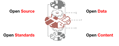
    The Department of Geography at Hunter College of the City University of New York and Hunter Continuing Education are offering a five day professional course in Free and Open Source GIS from August 4th to 8th, 2014. This five day course will span the entire range of GIS data capture, management, analysis, and visualization of geographic information using Free and Open Source Software (FOSS). These different elements of the GIS workflow will be discussed over the first four days and will then be applied in a final project completed on ...

    read more

    comments

  2. Python Resources for QGIS Users

    Tue 18 March 2014
    cfarmer

    There’s a discussion thread on the QGIS LinkedIn Group page about Python tutorials and resources. There were a few good suggestions, so I thought I’d share these with others. It starts with a very common question from a GIS (or any software that supports scripting) user:

    I’m a real ‘end-user’ of qgis and I want to improve my skills a little… I’ve found many python tutorials online but I don’t know which are any good. Can anyone point me to some good resources?

    The responses were useful, but not exhaustive:

    • The PyQGIS Programmer’s Guide ...

    read more

    comments

  3. Submission deadline extended!

    Sun 16 March 2014
    cfarmer

    SciPy 2014 Logo

    Due to popular demand, the deadline for submitting talks, tutorials and posters has been extended to April 1, 2014 - no ‘foolin!’. We encourage submissions related to general scientific computing with Python, one of the two special themes for this year, or the domain-specific mini-symposia held during the conference. Take a look at a few talks from previous years, our guidelines for this year, and we look forward to reviewing submissions!

    Submit your abstracts today!

    read more

    comments

  4. ESRI and Open Source

    Wed 12 March 2014
    cfarmer

    ESRI & Open Source

    Here’s a blog post from ESRI about ESRI’s transition to open source, open development, and social coding.* It features GitHub pretty prominently, which continues to be an awesome resource for collaborative work — and not just for code. My colleagues and I have started using it for planning meetings and workshops, developing research papers, maintaining websites (this site is hosted on GitHub), and yes, even open source software projects. ESRI obviously also thinks GitHub is a useful resource, and their keynote for the ESRI DevSummit is GitHub CEO and Co-Founder Chris Wanstrath!

    read more

    comments

  5. SciPy 2014 Geospatial Data in Science

    Thu 06 March 2014
    cfarmer

    SciPy 2014 Logo

    I have recently been asked to help out with the Geospatial Data in Science track for SciPy 2014 in Austin, Texas this coming July. The conference is being held at the AT&T Executive Education and Conference Center at the University of Texas campus in Austin, Texas from July 6th to 12th 2014. It promises to be an awesome gathering of scientific Python users, developers, and organizations. You can checkout the conference announcement on the SciPy 2014 website, where you can register to submit a proposal and/or abstract, and generally find out all about the SciPy community and conference.

    read more

    comments

  6. Essential Python Geospatial Libraries

    Fri 12 July 2013
    cfarmer

    Just so I don’t forget, here is a list of really awesome Python libraries that I’m using these days to do lots of fun things with spatial data [UPDATE: I’ve added a few more]:

    • pandas - For data handling and munging
    • shapely - For geometry handling
    • cartopy - For plotting spatial data
    • rtree - For efficiently querying spatial data
    • nodebox-opengl - For playing around with animations
    • statsmodels - For models and stats in Python (otherwise I’d use R)
    • numpy - For pretty much anything that involves arrays
    • geopy - For geolocating and things like that
    • ipython - For a wondering interactive environment in which to play
    • freetype-py - For converting font glyphs to polygons (odd I know…)
    • ogr/gdal - For reading, writing, and transforming geospatial data formats
    • pyqgis - For anything and everything GIS
    • fiona - For making it easy to read/write geospatial data formats
    • matplotlib - For all my plotting needs
    • networkx - For working with networks (duh!)
    • pelican - For blogging about all this stuff…
    • pysal - For all your spatial econometrics needs (and more)
    • descartes - For plotting geometries in matplotlib

    Based on Twitter and some of the comments below, I should also add:

    • geographiclib - For solving geodesic problems
    • pyshp - For reading and writing shapefiles (in pure Python)
    • pyproj - For conversions between projections

    Any others I’ve missed?

    read more

    comments

  7. Adding direct editing of geometry fields in QGIS

    Sat 12 March 2011
    cfarmer

    Being able to add/remove attributes isn’t actually a very new feature for QGIS at this point. However, to date non of the fTools functions (Vector menu) have taken advantage of this capability. If a tool needed to create a new field in the input vector layer, it simply wrote a new version of the vector layer to disk with the additional fields added. There have been several requests to allow some tools to add/update attributes directly on the input layers, so I went ahead and created a script to test this functionality out. I’ve provided a copy here for anyone who would like to test it out before I add it to QGIS permanently. Basically, the script will replace/update three of the Vector menu tools, including Analysis \> Sum line lengths, Analysis \> Points in polygon, and Geometry tools \> Add/Export geometry info.

    read more

    comments

  8. pgRouting, OpenStreetMap, and QGIS

    Thu 14 October 2010
    cfarmer

    I mentioned a few posts back that there was a great resource for downloading OpenStreetMap data, and that it was relatively easy to import osm data into PostgreSQL/PostGIS for use with pgRouting to calculate shortest paths and various other network-based operations. In this post, I’ll outline the steps required to get all this up and going, and provide a quick example to show how this can be combined with QGIS to visualise the computed shortest path directly.

    read more

    comments

1 / 3

twitter

recent visitors