1. Presentation at CAG 2012 in Waterloo

    Mon 28 May 2012
    cfarmer

    I am giving a talk and chairing a session at the Canadian Association of Geographers (CAG) Annual Meeting this week in Waterloo, Ontario, Canada. My session, entitled “Spatial Modelling”, is scheduled for Thursday at 08:30, and is supported by the CAG GIS Study Group. If you are in the neighbourhood, check out the session, and stick around for my talk: “Spatial interaction modelling of commuting flows within local labour markets”, which is also available online (best viewed at 90% on full screen).

    Hope I see you there!

    read more

    comments

  2. Visualising data with FatFonts

    Sat 26 May 2012
    cfarmer

    I recently posted an article on the CGI blog about some Visualizations that I produced with researchers from [St Andrews’ Computer Human Interaction Research Group (SACHI)][] using FatFonts, a tpographic Visualization technique developed by SACHI co-founder Miguel Nacenta and colleagues (Uta Hinrichs, and Sheelagh Carpendale). The initial Visualizations are now on-line, and feature flow matrices for English internal migration and commuting between Irish local labour markets. We have also produced several inforgraphics based on global oceans data that Dr Timothy Stojanovic and I are working with as part of Tim’s work linking off-shore cumulative human impacts to on-shore terrestrial urbanization (more on these graphics soon). I’m still experimenting with FatFonts at this stage, but so far, I’m quite pleased with the results, and find that they offer a nice way to add beauty to my potentially boring data!

    read more

    comments

  3. Introducing the Centre for GeoInformatics

    Thu 24 May 2012
    cfarmer

    image

    The new Centre for GeoInformatics (CGI) within the School of Geography and Geosciences and the Department of Geography and Sustainable Development is now an official university Research Centre at the University of St Andrews in Scotland! A few months ago, I started my new job as Research Fellow with CGI, where I am continuing to work with Prof. A. Stewart Fotheringham, who is the director of the new centre, along with several new and continuing PhD students and faculty members. Now that we have the centre officially up and running, we are quickly getting ready for our official launch next ...

    read more

    comments

  4. Paper published in International Journal of Applied Earth Observation and Geoinformation

    Fri 13 April 2012
    cfarmer

    An article I worked on with Lex Comber and Chris Brunsdon, “Community detection in spatial networks: Inferring land use from a planar graph of land cover objects”, has recently been published on-line, with the International Journal of Applied Earth Observation and Geoinformation. The article can be cited as:

    Comber, A. J., Brunsdon, C. F., and Farmer, C. J. Q.(2012) Community detection in spatial networks: Inferring land use from a planar graph of land cover objects. International Journal of Applied Earth Observation and Geoinformation, 18: 274–282

    If you would like a copy, but do not have access to the ...

    read more

    comments

  5. Research dissemination and interactive visuals

    Tue 10 April 2012
    cfarmer

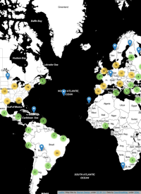
    One of my goals for this year is to spend more time and effort developing effective Visualizations for my various research projects, in an effort to make my research more accessible to others. This is one thing that I think many academics are particularly bad at: letting others know what they are up to, and why it might be something worth looking at. In order to avoid this pitfall, I plan to focus on producing interactive, web-based visuals suitable for a more general audience in addition to more traditional forms of research dissemination such as journals and conference papers. It is my hope that by doing this, I will be making my research more readily available to those who might actually be able to use it, and maybe even create some compelling Visualizations in the process. While I’m not quite ready to start creating full-blown interactive websites yet, I thought it might be a good idea to start with something small to get the ball rolling; so I put together an upgraded version of my previous map of visitors to www.carsonfarmer.com.

    read more

    comments

  6. Because its fun to map stuff…

    Fri 30 March 2012
    cfarmer

    Its been quite a while since my last post, and its Friday and I was feeling creative, so I decided to map something! I’ve been looking for an excuse to produce a nice graphic like the one Anita Graser created to represent Vienna’s green-spaces. She used Quantum GIS to produce a hexagonal grid for representing the density of Viennese trees instead of the standard heat map or kernel density map, and the results are quite nice! I’m a huge fan of QGIS, but I tend to do most of my work in R, so I decided to ...

    read more

    comments

  7. Environment and Planning A paper published

    Thu 01 December 2011
    cfarmer

    My latest article, “Network-based functional regions”, has recently been published on-line, with Environment and Planning A. The article can be cited as:

    Farmer C J Q, Stewart Fotheringham A, 2011, “Network-based functional regions” Environment and Planning A 43(11) 2723 – 2741

    If you would like a copy, but do not have access to the article, please email me and I can forward you a PDF version.

    read more

    comments

  8. It’s about time…

    Wed 09 November 2011
    cfarmer

    Well its been a long time since my last post, but I do have a relatively good reason: I was finishing up my PhD thesis. The good news is that I’m now done and graduated! I’m hoping I’ll have a bit more time to blog and continue working on side-projects that I had to put on-hold while finishing up. My plan for the next few months is to finish up here in Maynooth, (unofficially) start some post-doc work, and finish/get going on several papers on my PhD research. I’m also going to try to learn Bayesian statistics, fiddle about with some visualizations I’ve been working on, and start getting back into QGIS and Python development again

    In the mean time, I’ve put together a fun little visualization of my PhD thesis in the form of a word-cloud.

    read more

    comments

8 / 13

twitter

recent visitors